How Vehicle Positions Are Recorded in Nevada Crash Reports
Understanding how vehicle positions are recorded in Nevada crash reports can help demystify the reporting process following a collision. Vehicle positioning is a critical element for reconstructing accidents and determining several key factors behind each incident. The State of Nevada, through its law enforcement agencies and detailed crash documentation protocols, ensures that vehicle placement and movement are accurately logged, which contributes to consistent traffic safety data and informed public policy.
Overview of Crash Response and Reporting Systems in Nevada
When a roadway incident occurs in Nevada, a systematic crash response is triggered, involving trained law enforcement and standardized documentation tools. The primary goal is to ensure public safety, facilitate medical or emergency aid, and establish an impartial, accurate record of the event. These records, known as crash or accident reports, are managed at both the state and local levels. They encompass vital details such as road conditions, environmental circumstances, and most importantly, the positions of all vehicles involved.
Vehicle positioning refers to showing the placement of vehicles before, during, and after a collision. Precisely logging these aspects serves multiple purposes: aiding insurance investigations, supporting traffic studies, and optimizing roadway safety measures.
Common Agencies and Reporting Steps
Nevada’s crash reporting is carried out by an array of law enforcement agencies, each equipped with their own protocols, yet unified under state standards. The Nevada Highway Patrol, various city Police Departments (such as the Las Vegas Metropolitan Police Department), and County Sheriff’s offices are among the primary responders.
After law enforcement arrive at the scene of a crash, officers undertake several responsibilities. They ensure the safety of those involved, manage potential hazards, and begin gathering essential data for the official crash report. Part of this process involves evaluating the final position of every vehicle involved. Officers assess the scene, noting where each vehicle came to rest in relation to the roadway, intersections, traffic signals, and other environmental markers.
Often, the information about vehicle positions is supplemented with observations from witnesses, drivers, or other first responders. This collective input bolsters the accuracy of the official report and provides a more comprehensive context for every collision.
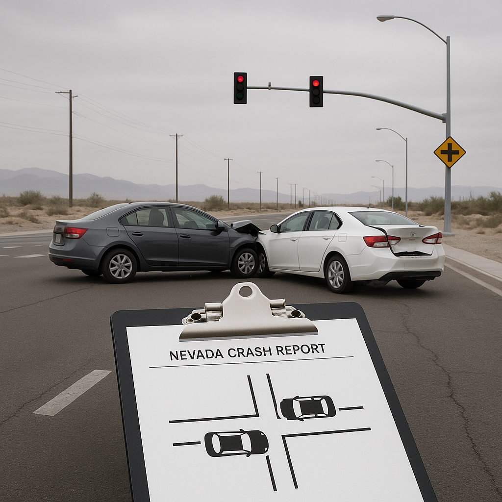
Documentation Typically Involved
Recording vehicle positions in Nevada crash reports is a meticulous process, often utilizing diagrams, narratives, and specific codes. At the center of this work is the Nevada State Accident Report form, which includes dedicated sections for diagrammatic representation and written descriptions.
Crash Diagrams
One major feature is the crash sketch — a simplified overhead diagram that visually conveys vehicle positions before and after the collision. These sketches feature:
– Roadway layout: Markings of lanes, crosswalks, traffic signals, and points of impact.
– Vehicle icons: Each vehicle is represented, with identifying symbols or labels (such as “Unit 1,” “Unit 2”).
– Directional markers: Arrows or lines may indicate the direction each vehicle was traveling.
– Final rest positions: Vehicle placements are pinpointed to show where vehicles came to rest post-collision.
Written Narratives
The narrative section supplements the diagram, detailing movements such as lane changes, angle of collision, and vehicle maneuvers leading up to impact. Officers may also reference nearby landmarks or roadway features, further establishing the specific situational context.
Specialized Codes and Boxes
Further standardization is achieved through checkboxes and code fields indicating types of collisions (rear-end, side-impact, etc.), impacted sections of vehicles, and other critical spatial factors. This structured approach ensures uniformity, making the data easier to interpret and analyze by interested stakeholders in law enforcement, insurance, or traffic engineering.
Common Reporting Misunderstandings
Misconceptions surrounding how vehicle positions are recorded in Nevada crash reports are not uncommon. One frequent misunderstanding is the belief that the exact, precise locations of vehicles at every phase of the collision are always logged with perfect accuracy. In reality, several factors may limit the detail or precision at the scene.
First, the chaotic environment immediately after a crash—affected by moving vehicles, emergency response actions, and driver or witness statements—can sometimes result in approximations rather than absolute coordinates or measurements. Officers are trained to provide the most reliable depiction possible, but the rapidly changing scene may influence their ability to capture every detail.
Another image is that crash diagrams are to scale, functioning like architectural blueprints. In truth, these sketches are not technical drawings but are designed to provide a clear, simplified representation for understanding vehicle positioning and movement. The emphasis is on conveying key spatial relationships relevant to the collision rather than producing a scaled map.
There’s also confusion regarding whose account of vehicle positions prevails if there are discrepancies among drivers, witnesses, and the reporting officer. Typically, the officer at the scene synthesizes all available information, but the final report represents their judgment based on physical evidence, witness accounts, and their training in crash scene reconstruction.
Finally, some drivers may expect the crash report to serve as a definitive tool for assigning blame or determining fault, but the primary function of recording vehicle positions is to inform further investigation, not to offer legal conclusions.
Neutral Closing Paragraph
While the task of recording vehicle positions in Nevada crash reports is both systematic and thorough, it is ultimately a human process that relies on trained observation, standardized forms, and the information available at what are often hectic scenes. These documented positions play a vital role in supporting broader roadway safety initiatives and give stakeholders, from traffic engineers to insurance professionals, valuable insight into collision dynamics. As Nevada continues to develop its crash reporting systems, these records will remain a foundational component of the state’s commitment to traffic safety and accurate public documentation.