The Vital Reno to California Freight Corridor: Key Insights for Nevada’s Trucking Activity
Overview of the Reno to California Freight Corridor
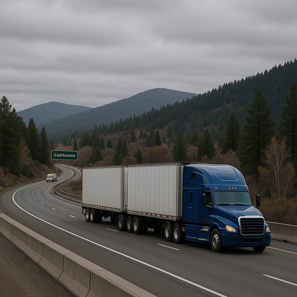
The Reno California freight corridor is a critical artery in Nevada’s transportation matrix, serving as a bridge between the Silver State and the vast economic engine of California. Situated on the eastern edge of the Sierra Nevada mountains, Reno has developed into a significant logistics hub—a gateway for goods flowing into and out of the Golden State. The region’s unique geography, economic diversity, and strategic location all combine to make this corridor a center of robust freight activity.
Several major routes define this corridor, but Interstate 80 (I-80) stands out as the premier freight highway. The interstate stretches from San Francisco, crosses the Sierra Nevada through Donner Pass, and winds its way into Reno and beyond. US-395 is another essential route, connecting northern Nevada to California’s central valley and beyond. Thanks to Reno’s proximity to both northern and central California, the corridor is heavily utilized for shipping consumer goods, manufacturing inputs, agricultural products, and more.
Given Nevada’s welcoming business climate, many distribution centers, warehouses, and e-commerce hubs have popped up in and around Reno. Retail giants, automotive suppliers, technology manufacturers, and food logistics companies all leverage Reno’s location for efficient goods movement. As a result, the Reno California freight corridor not only supports local Nevada businesses but also plays a vital role in the larger regional supply chain.
Common Truck Types and Freight Activity in the Area
A diverse mix of trucks and cargos can be seen along the Reno California freight corridor, reflecting the complex web of commerce that relies on this route. The types of trucks and trailers commonly observed include:
– Dry vans: These are the workhorses of freight, transporting packaged goods, electronics, apparel, and anything that requires enclosure from weather.
– Refrigerated trucks (reefers): With Reno acting as a key distribution point for groceries, produce, and pharmaceuticals, refrigerated trucks are crucial, particularly for perishable foods moving from or into California’s agricultural heartland.
– Flatbed trucks: These are routinely found carrying construction materials, heavy machinery, large industrial components, or manufactured housing units.
– Tanker trucks: Delivering fuel, chemicals, and food-grade liquids, tankers make frequent trips along the corridor.
– Intermodal containers: With Reno’s growing rail connections, containers shipped by train are often transferred to tractor-trailers for the final leg into or out of California.
Freight activity peaks around some industries more than others. For example, e-commerce fulfillment activity in Reno has surged in the last decade, and warehouses in the region ship goods daily to California’s vast consumer market. Automotive parts and technology equipment, semiconductor components, and processed food products also make the daily journey across the state line.
Beyond general goods, the corridor also supports seasonal agricultural shipments from California’s central valley into Reno and further east. Meanwhile, mining equipment and raw materials from northern Nevada mines are frequently transported into California for further processing or export.
How Congestion or Merging Creates Risk
Given its pivotal role, the Reno California freight corridor is prone to various traffic and safety risks, particularly where congestion or merging occurs. This is especially true as traffic enters or exits the cities of Reno and Sparks, or along the challenging grades and curves of Sierra Nevada mountain passes.
Congested Spots and Peak Merging Zones
A few specific areas tend to see higher congestion and complex merging patterns:
– Truckee and Donner Pass (I-80): As the highway climbs and descends through the Sierra Nevada, a combination of steep grades, tight curves, and variable weather creates slow-moving convoys of trucks and cars. Merging onramps and lane reductions near rest areas, chain installation zones, and inspection stations can trap vehicles in unpredictable patterns.
– Reno-Sparks urban area: Here, I-80 and US-395 often see local passenger vehicles mixing with long-haul trucks. Highway interchanges create frequent merging, lane switching, and potential bottlenecks, increasing the chance for abrupt stops or rear-end collisions.
– Distribution center clusters: The growing number of warehouses means concentrated truck traffic, especially during peak shift changes or morning dispatch windows. Dense clusters of trucks entering and exiting arterial roads add complexity to the corridor.
Risk Factors
– Limited visibility: Mountainous terrain, tight curves, and sudden changes in weather can reduce sightlines, increasing the risk during unexpected slowdowns or merges.
– Speed differentials: Trucks may go much slower than passenger vehicles on steep grades, causing abrupt lane changes around them.
– Heavy volumes at certain times: When multiple trucks attempt to enter or leave the highway at logistic hot spots, merging becomes challenging, especially during rush hours or weather events.
– Driver fatigue and distraction: Long hours and demanding schedules increase the risk profile for all drivers on the corridor.
Recognizing the risk factors and being aware of the corridor’s unique merging and congestion areas are key steps for anyone traveling or working along these routes.
Time-of-Day and Seasonal Traffic Trends
Understanding when and how truck traffic changes over time is important for both safety and effective logistics.
Time-of-Day Patterns
The Reno California freight corridor experiences a synthesis of commercial and commuter traffic. Early mornings, especially between 5:00 AM and 9:00 AM, tend to see high outbound truck volume from Reno’s distribution centers, as loads are dispatched for early deliveries in California. Similarly, late afternoon to early evening (3:00 PM–7:00 PM) brings a wave of inbound trucks returning to depots, clashing with local commuter traffic, especially through the Reno-Sparks urban stretch.
Highway rest stops and fuel stations along I-80 and US-395 are busiest in these windows, as truckers coordinate legally mandated breaks with logistical schedules. Overnight, truck traffic is steadier, but limited visibility and fatigue can increase risk.
Seasonal Factors
Weather and seasonal business cycles significantly shape traffic trends. Winter brings substantial challenges. The Sierra Nevada can see heavy snow, ice, or fog, prompting chain controls, road closures, or lengthy delays. Donner Pass is especially notorious for winter weather impacts, often requiring additional chain-up stops and increasing congestion at key spots.
In spring and early summer, agricultural shipments intensify. Harvests in California’s central valley generate spikes in refrigerated and flatbed truck traffic headed to Nevada and beyond. E-commerce peaks during the holiday period—from late October through December—put further pressure on Reno’s logistics hubs and the interstates.
Occasional wildfires in northern California can also force closures or diversions, especially in late summer and early fall, severely affecting freight schedules and pushing trucks onto alternate Nevada routes like US-50 or I-580.
By monitoring time-of-day trends and watching the calendar for business cycles or weather events, carriers and other road users can plan for safer and more efficient trips along the Reno California freight corridor.
Closing Thoughts
The Reno California freight corridor is a dynamic and vital link in Nevada’s economic landscape. As the logistics and distribution sectors continue to expand in the greater Reno area, understanding the region’s freight activities, truck types, congestion risks, and traffic trends becomes increasingly important. Recognizing these realities helps businesses, drivers, and the community work together toward safer, more efficient transport across this crucial corridor—supporting Nevada’s growth and its important role connecting the West.