Truck Accident Hotspots Near Freight Distribution Centers in Nevada
Overview of the Nevada Location or Highway Segment
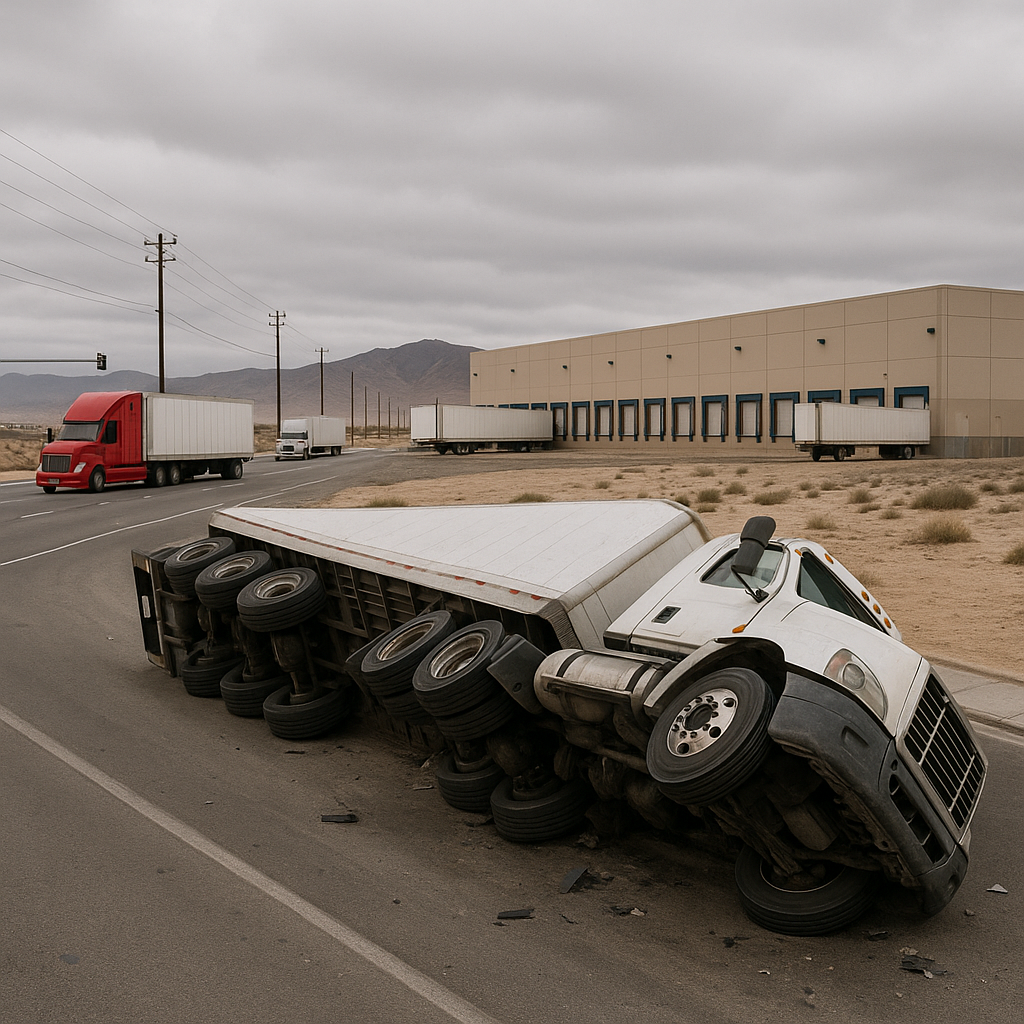
Nevada’s reputation as a logistics hub is growing, thanks to its strategic geography, business-friendly environment, and proximity to major western markets. The state is crisscrossed by vital interstate corridors, and several cities—including Las Vegas, Reno, Sparks, and North Las Vegas—have flourished as significant freight distribution centers. These areas serve as bustling nexuses for the transportation sector, with 18-wheelers and delivery trucks constantly streaming in and out from warehouses, factories, and shipping terminals.
Major highway segments near these freight centers—such as Interstate 15 (I-15) near Las Vegas, Interstate 80 (I-80) around Reno and Sparks, and the U.S. Route 95 (US-95) corridor—see some of Nevada’s highest truck volumes. These same stretches are recognized as truck accident hotspots, meaning the risk of large commercial vehicle collisions is significantly higher in their vicinity.
Why Truck Accidents Are More Common in This Area
Several unique characteristics make areas near Nevada’s freight distribution centers more prone to truck accidents.
These zones often combine extremely high volumes of heavy vehicles, hurried timetables, and a constant mix of passenger cars, local delivery vehicles, and tractor-trailers. Additional factors such as ramp congestion, loading docks feeding directly onto major routes, and complex road layouts can compound the risks. Shifting activity peaks—such as the arrival or departure of shipments—create uneven traffic flows that can change rapidly throughout the day.
Moreover, Nevada’s commercial areas are typically built close to major transportation arteries to allow easy access for inbound and outbound shipments. As a result, there’s a remarkable density of freight-related movements, particularly at certain junctions and interchanges. These factors create a complex and sometimes hazardous environment for all road users.
Road Design Factors That Influence Crashes
Roadway design plays a critical role in accident frequency near Nevada’s freight centers. Several design features and configurations found in these hotspots can influence truck accident risk:
– Interchanges and On/Off Ramps: Truck terminals and warehouses are frequently situated near highway exits. These ramps can quickly become chokepoints, with trucks entering and exiting the freeway, slowing or stopping, or merging with high-speed passenger traffic. The mix of vehicle sizes and speeds raises the likelihood of collisions.
– Short Acceleration and Deceleration Lanes: Many distribution-centric segments around Reno or North Las Vegas feature shorter-than-ideal lanes for trucks entering or exiting highways. Limited space can force abrupt lane changes or sudden braking, especially for long or heavily loaded rigs.
– Wide Turning Radii and Multiple Driveway Entrances: Large industrial lots require broad turns and several ingress/egress points. At certain stretches, such as along USA Parkway near Tahoe-Reno Industrial Center, these features can create unpredictable traffic paths, increasing the chances of side-impact incidents.
– Inadequate Lighting and Visibility: Some freight zones, especially those operating 24/7 or in developing industrial parks, have limited street lighting or signage. Reduced visibility during nighttime operations or inclement weather can lead to difficulty gauging truck speeds and positions—an important factor in accidents on the periphery of centers near Fernley or Sparks.
– Surface Condition and Maintenance: Potholes, cracked asphalt, or poorly marked roads near busy loading docks or access routes can challenge maneuvering, particularly for trucks with high centers of gravity or full cargo loads.
Traffic Patterns and Truck Volume Considerations
Nevada’s freight centers come alive in shifts, with truck flows not steady but surging in distinct peaks:
– Shift Changes and Freight Schedules: At the Reno-Tahoe Industrial Center and Las Vegas Global Logistics Center, truck traffic often spikes in conjunction with warehouse operational shifts or scheduled carrier departures. Morning influxes and evening departures amplify truck density on roads at predictable hours.
– Intermodal Transfers: Facilities connecting highways to rail or air freight amplify multi-directional movements, as seen around McCarran International Airport or Union Pacific railyards. The interplay between trucks arriving and departing these facilities requires constant vigilance.
– Truck-Passenger Vehicle Interactions: Nevada’s major freight centers draw not just truckers but also legions of employees and local commuters. School buses, passenger cars, and light delivery vans mingle with big rigs, creating a dynamic mix of vehicle types, sizes, and speeds.
– Frequent Stops and Slowdowns: Delivery and pickup locations often require trucks to stop or slow suddenly to access gates. These zones see increased rear-end and side-collision risks, particularly when passenger vehicles attempt to pass or merge unexpectedly.
High-volume corridors—such as I-80 between Reno, Sparks, and Fernley, and I-15 near North Las Vegas—are thus uniquely complex, marked by unpredictably dense traffic, sudden shifts in speed, and high-stress driving conditions for all.
Safety Awareness Considerations (Non-Advice Tone)
Drivers—whether piloting a compact car or a fully loaded big rig—encounter a set of distinctive risks in Nevada’s freight zones. Understanding these patterns and hazards can contribute to greater alertness and improved situational awareness.
Many trucking companies, warehouses, and distribution centers in the Silver State have implemented access management techniques designed to guide truck flow and reduce bottlenecks. In heavily trafficked sectors, electronic signage may alert all motorists to upcoming slow-moving vehicles, lane shifts, or frequent merging activity.
Awareness also increases during busy periods or near common choke points, such as the USA Parkway ramps, where both truck and non-commercial drivers may need extra caution. Local authorities and the Nevada Department of Transportation often monitor these hotspots, gathering data to inform future infrastructure improvements.
The interplay between freight demands and regional traffic patterns means that congestion and hazardous scenarios may ebb and flow throughout the day. Recognizing these rhythms—such as the surge after shift changes or the morning queue of outbound trucks—can be valuable for drivers as they share the roads with commercial vehicles.
Technology is also changing the safety landscape. Many logistics hubs around Reno and Las Vegas now employ fleet telematics, GPS tracking, and real-time traffic analysis to optimize routes and timing, contributing to coordinated movement and reduced congestion during peak periods.
Neutral Closing Paragraph
Nevada’s freight distribution centers are vital engines of economic growth, connecting the state along key transportation corridors. While these hubs support thousands of jobs and facilitate substantial trade, the areas surrounding them—particularly on adjacent highways and arterial roads—see above-average rates of truck-involved accidents. By understanding the factors that contribute to these crash hotspots, from specific road designs to fluctuating traffic volumes, local communities, transportation professionals, and policymakers can continue to work toward safer, more efficient freight movement throughout the Silver State.